
Kargil :
Kargil district is in the Himalayas, giving it a cool, temperate climate. Summers are warm with cool nights, while winters are long and cold with temperatures often dropping to −40 °C with recorded temperatures of −60°C in Drass, especially in the tiny town of Drass which is situated 56 km from the Kargil town. The Zanskar plateau is even colder, thus making it a near-uninhabitable place for humans to stay, except for the hardy Khampas. The entire Kargil district is spread over 14,086 km². The Suru River flows through the district.
National Highway 1D connecting Srinagar to Leh that also passes through Zoji La, cuts through Kargil. This highway is open for traffic only from June to mid November every year due to heavy snowfall at the Zoji La (but in recent years it has been opened much before june, april ending.). Kargil is located 120 miles (204 km) from the capital city of Srinagar. There is a partially paved road ( the first 40 km or so) leading from Kargil south to Zanskar which is a distance of nearly 220 km, which is only open from June to September each year.
The name Kargil is said to be derived from the words Khar and rKil. Khar means castle and rKil means center thus a place between castles as the place lay between many kingdoms. The competing theory is that Kargil has been derived from the words "Gar" and "Khil". Gar in local language mean ‘Any where’ and Khil means a central place where people could stay.
A popular attraction of Kargil is the archery contest held in the month of May every year. Kargil is quite well known for its delicious dry apricots and the apricot jam. For the shoppers, the town offers Pashmina shawls, local carpets and woolen handicrafts. The Buddhist monastery of Mulbek Gompa, situated 45 km from Kargil. It is an architectural beauty with magnificent murals and amazing statues.
Zanskar (Penzila to Padum Karsha and Zangla)
Two small, turquoise, high altitude lakes with camping sites, and views of the surrounding permafrost mountains are the highlights of the Penzi La pass, which is 160 Km from Kargil and at an altitude of 4,401 to 4,450 meters, the highest point on the Kargil – Zanskar road. This pass is more of a table land and, unlike the Zojila, has plenty of flat spaces and things to see, the Drang-Drung, for instance. Kishtwar is behind the mountains of the right.
Sani :
Emperor Kanishka (Aka Kanika) had got 108 chortens constructed in the first century AD. One of them is in Sani. The holy site at Sani is called Turtot Gyat and is one of the 8 holiest Buddhist sites in the world. That is why most of the Luminaries of Himalayan Buddhism including Padma Sambhava, Naropa and Marpa have visited Sani. This venerable monastery had ancient and medieval frescoes.
Rangdum Monastery :
Rangdum: (3,657 meters, 130 km from Kargil town, 65 Km from Panikhar). The Rangdum monastery has tiny “museum” with interesting Tibetan and other artifacts. Around forty monks live in the gompa. It is difficult to agree with accounts that date the Gompa to the 8th century. 18th century is more likely. The villagers who live near the Gompa are basically the agriculture shrifts of the monastery, a guidebook informs us.
Zongkhul :
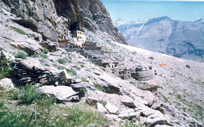
This monastery is built in a spectacular cave, lies on the Padum-Kishtwar trekking route, just before the ascent to the Omasi-La Pass begins. Situated like a swallow's nest on the rock face of the Ating Gorge, the monastery is associated with Naropa, a famous India Yogi. The two caves around which the present monastery has developed are said to have been used by Naropa for solitary mediation. The frescos on the cave walls are very old and reflect a high degree of artistic achievement.
BY ROAD - Regular buses of the state road transport of Jammu and Kashmir ply between Srinagar and Kargil. You may even hire cars or jeeps for road transportation. Local buses like the mini coaches make the other options for travel. It is the capital city of Srinagar that connects the major cities of India with Kargil through air.

